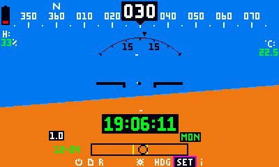
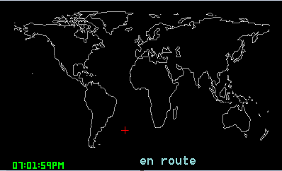
Simple set up. Looks like a typical artificial horizon
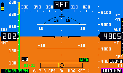
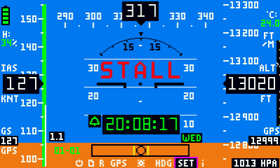
More complex display, with time minimized at the bottom left
All flight indicators can be enabled or disabled as per user configuration. Thus the display can vary from a simple artificial horizon to a more complicated EFIS.
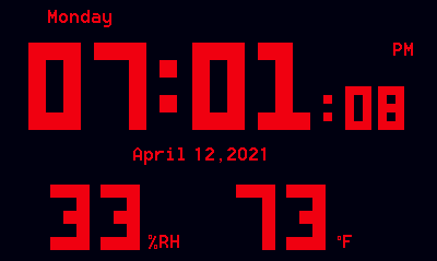
Selectable larger, medium or small fonts for clock time. 24-hour and 12-hour time format. Date as “month-day” or “day-month”.
Temperature in degrees Celsius or Fahrenheit
Clock Alarm -programmable by weekday(s) and customizable text and audio
Ambient Temperature and/or Humidity Alarm
Preset chime
Min/Max Temperature & Humidity memory. Memory card log
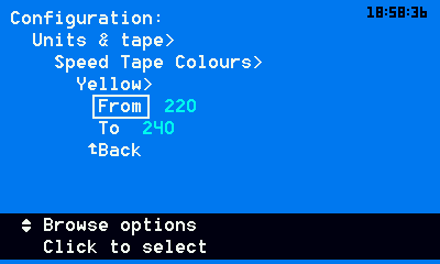
Easy to use configuration menu with self-explanatory settings
Secondary operation as a classic stand alone digital photo-frame
Backup coin battery option maintains time keeping during power failures
Typical power consumption is less than 1watt (a lot less that the typical LED wall-powered clocks rated at about 5 to 7 watts)
Common USB power interface
Easy settings menu with help text
Basic info screen. Will look like a typical digital clock to an unsuspecting friend. Well, at least until it “changes”